 vesseltracker.com
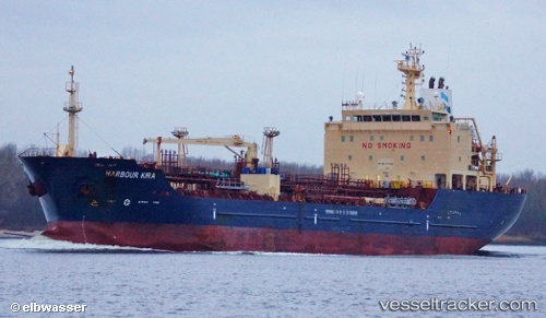
Vessel Caribe Maria IMO: 9337286, MMSI: 636017331 Chemical Oil Products Tanker
UTC, 29.72716, -95.27309, course: 318, speed: 0
UTC, 29.72715, -95.27302, course: 317, speed: 0
2026-01-28 23:22:58 UTC, 29.72716, -95.27307, course: 318, speed: 0
Live AIS position:
UTC. Near Houston),
updated 2026-01-28 23:22:58 UTC.
Find the position of the vessel Caribe Maria on the map. The latter are known coordinates and path.
marine traffic ship tracker show on live map
The current position of vessel Caribe Maria is 29.72716 lat / -95.27307 lng. Updated: 2026-01-28 23:22:58 UTCCurrently sailing under the flag of Liberia
Caribe Maria built in 2007 year
Deadweight:
11299 tDetails:
Last coordinates of the vessel:
UTC, 29.72714, -95.27304, course: 318, speed: 0UTC, 29.72716, -95.27309, course: 318, speed: 0
UTC, 29.72715, -95.27302, course: 317, speed: 0
2026-01-28 23:22:58 UTC, 29.72716, -95.27307, course: 318, speed: 0