 vesseltracker.com
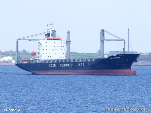
Vessel Cala Paguro IMO: 9412787, MMSI: 636017440 Container Ship
UTC, 1.27132, 103.78563, course: 31, speed: 0
UTC, 1.27122, 103.78558, course: 31, speed: 0
2026-02-17 14:17:37 UTC, 1.27106, 103.78568, course: 31, speed: 0.1
Live AIS position:
UTC. Near Pasir Panjang Wharves),
updated 2026-02-17 14:17:37 UTC.
Find the position of the vessel Cala Paguro on the map. The latter are known coordinates and path.
marine traffic ship tracker show on live map
The current position of vessel Cala Paguro is 1.27106 lat / 103.78568 lng. Updated: 2026-02-17 14:17:37 UTCCurrently sailing under the flag of Liberia
Cala Paguro built in 2007 year
Deadweight:
21442 tDetails:
Last coordinates of the vessel:
UTC, 1.27038, 103.78645, course: 31, speed: 0.1UTC, 1.27132, 103.78563, course: 31, speed: 0
UTC, 1.27122, 103.78558, course: 31, speed: 0
2026-02-17 14:17:37 UTC, 1.27106, 103.78568, course: 31, speed: 0.1