 vesseltracker.com
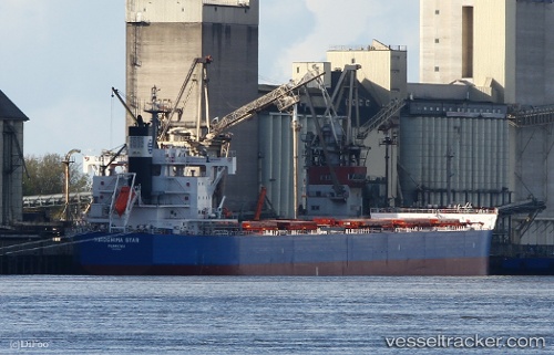
Vessel Hiroshima Star IMO: 9770567, MMSI: 636017757 Bulk Carrier
UTC, 30.65728, -88.03239, course: 183, speed: 0
UTC, 30.65726, -88.03237, course: 183, speed: 0
2026-01-15 05:31:22 UTC, 30.65729, -88.03240, course: 183, speed: 0.1
Live AIS position:
UTC. Near Pinto Island),
updated 2026-01-15 05:31:22 UTC.
Find the position of the vessel Hiroshima Star on the map. The latter are known coordinates and path.
marine traffic ship tracker show on live map
The current position of vessel Hiroshima Star is 30.65729 lat / -88.03240 lng. Updated: 2026-01-15 05:31:22 UTCDetails:
Last coordinates of the vessel:
UTC, 30.65729, -88.03237, course: 183, speed: 0.1UTC, 30.65728, -88.03239, course: 183, speed: 0
UTC, 30.65726, -88.03237, course: 183, speed: 0
2026-01-15 05:31:22 UTC, 30.65729, -88.03240, course: 183, speed: 0.1