 vesseltracker.com
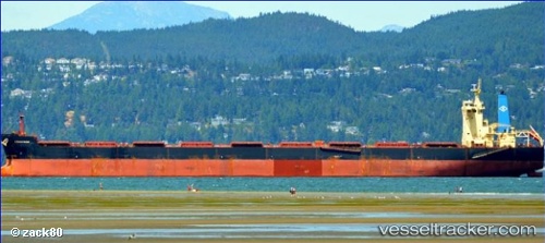
Vessel Amigo Ii IMO: 9580364, MMSI: 636017806 Bulk Carrier
UTC, 29.77601, 122.06819, course: 224, speed: 0
UTC, 29.77594, 122.06810, course: 224, speed: 0
2026-01-30 07:22:49 UTC, 29.77593, 122.06813, course: 224, speed: 0.1
Live AIS position:
UTC. Near Daxie Pt),
updated 2026-01-30 07:22:49 UTC.
Find the position of the vessel Amigo Ii on the map. The latter are known coordinates and path.
marine traffic ship tracker show on live map
The current position of vessel Amigo Ii is 29.77593 lat / 122.06813 lng. Updated: 2026-01-30 07:22:49 UTCCurrently sailing under the flag of Liberia
Details:
Last coordinates of the vessel:
UTC, 29.77599, 122.06807, course: 224, speed: 0UTC, 29.77601, 122.06819, course: 224, speed: 0
UTC, 29.77594, 122.06810, course: 224, speed: 0
2026-01-30 07:22:49 UTC, 29.77593, 122.06813, course: 224, speed: 0.1