 vesseltracker.com
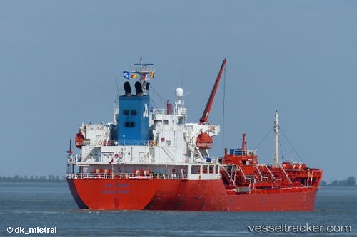
Vessel Stolt Kiri IMO: 9266231, MMSI: 636017828 Chemical Oil Products Tanker
UTC, 29.35246, -94.75120, course: 224, speed: 0.1
UTC, 29.35163, -94.75050, course: 262, speed: 0.1
2026-01-29 06:09:02 UTC, 29.35164, -94.75046, course: 259, speed: 0
Live AIS position:
UTC. Near Port Bolivar),
updated 2026-01-29 06:09:02 UTC.
Find the position of the vessel Stolt Kiri on the map. The latter are known coordinates and path.
marine traffic ship tracker show on live map
The current position of vessel Stolt Kiri is 29.35164 lat / -94.75046 lng. Updated: 2026-01-29 06:09:02 UTCDetails:
Last coordinates of the vessel:
UTC, 29.35193, -94.75351, course: 105, speed: 0UTC, 29.35246, -94.75120, course: 224, speed: 0.1
UTC, 29.35163, -94.75050, course: 262, speed: 0.1
2026-01-29 06:09:02 UTC, 29.35164, -94.75046, course: 259, speed: 0