 vesseltracker.com
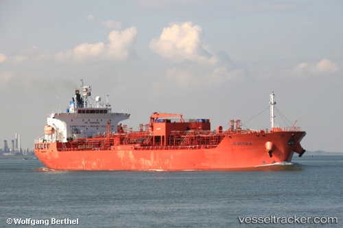
Vessel Stolt Betula IMO: 9266267, MMSI: 636017837 Chemical Oil Products Tanker
UTC, 51.43173, 3.57822, course: 260, speed: 9.3
UTC, 51.36733, 2.80877, course: 267, speed: 14.1
2026-01-17 16:54:48 UTC, 51.36857, 2.69387, course: 284, speed: 9.8
Live AIS position:
UTC. 12 nm NW of Oostende),
updated 2026-01-17 16:54:48 UTC.
Find the position of the vessel Stolt Betula on the map. The latter are known coordinates and path.
marine traffic ship tracker show on live map
The current position of vessel Stolt Betula is 51.36857 lat / 2.69387 lng. Updated: 2026-01-17 16:54:48 UTCDetails:
Last coordinates of the vessel:
UTC, 51.43237, 3.58422, course: 260, speed: 9.5UTC, 51.43173, 3.57822, course: 260, speed: 9.3
UTC, 51.36733, 2.80877, course: 267, speed: 14.1
2026-01-17 16:54:48 UTC, 51.36857, 2.69387, course: 284, speed: 9.8