 vesseltracker.com
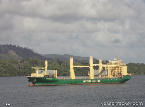
Vessel Aal Kembla IMO: 9498353, MMSI: 636018137 Multi Purpose Carrier
UTC, 30.96333, 146.60834, course: -1, speed: 9
UTC, 30.81167, 146.86667, course: -1, speed: 9
2026-02-09 05:23:46 UTC, 30.67628, 147.10391, course: -1, speed: 9.9
Live AIS position:
UTC. 337 nm NE of Omura),
updated 2026-02-09 05:23:46 UTC.
Find the position of the vessel Aal Kembla on the map. The latter are known coordinates and path.
marine traffic ship tracker show on live map
The current position of vessel Aal Kembla is 30.67628 lat / 147.10391 lng. Updated: 2026-02-09 05:23:46 UTCCurrently sailing under the flag of Liberia
Aal Kembla built in 2011 year
Deadweight:
31000 tDetails:
Last coordinates of the vessel:
UTC, 31.11500, 146.03500, course: -1, speed: 10UTC, 30.96333, 146.60834, course: -1, speed: 9
UTC, 30.81167, 146.86667, course: -1, speed: 9
2026-02-09 05:23:46 UTC, 30.67628, 147.10391, course: -1, speed: 9.9