 vesseltracker.com
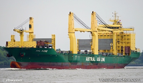
Vessel Aal Kobe IMO: 9498444, MMSI: 636018143 Multi Purpose Carrier
UTC, 29.73366, -95.27658, course: -1, speed: 0
UTC, 29.73363, -95.27658, course: -1, speed: 0
2026-01-28 07:53:15 UTC, 29.73358, -95.27667, course: -1, speed: 0.1
Live AIS position:
UTC. Near Houston),
updated 2026-01-28 07:53:15 UTC.
Find the position of the vessel Aal Kobe on the map. The latter are known coordinates and path.
marine traffic ship tracker show on live map
The current position of vessel Aal Kobe is 29.73358 lat / -95.27667 lng. Updated: 2026-01-28 07:53:15 UTCCurrently sailing under the flag of Liberia
Aal Kobe built in 2012 year
Deadweight:
32043 tDetails:
Last coordinates of the vessel:
UTC, 29.73365, -95.27660, course: -1, speed: 0UTC, 29.73366, -95.27658, course: -1, speed: 0
UTC, 29.73363, -95.27658, course: -1, speed: 0
2026-01-28 07:53:15 UTC, 29.73358, -95.27667, course: -1, speed: 0.1