 vesseltracker.com
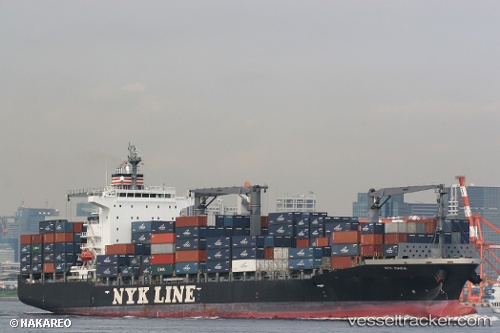
Vessel Nyk Maria IMO: 9406764, MMSI: 636018223 Container Ship
UTC, 28.75333, 122.45500, course: -1, speed: 14
UTC, 28.22333, 122.09833, course: -1, speed: 14
2026-01-29 09:26:08 UTC, 27.93823, 121.93313, course: 209, speed: 13
Live AIS position:
UTC. 29 nm S of Wenling Longmen Port),
updated 2026-01-29 09:26:08 UTC.
Find the position of the vessel Nyk Maria on the map. The latter are known coordinates and path.
marine traffic ship tracker show on live map
The current position of vessel Nyk Maria is 27.93823 lat / 121.93313 lng. Updated: 2026-01-29 09:26:08 UTCDetails:
Last coordinates of the vessel:
UTC, 28.96167, 122.63333, course: -1, speed: 15UTC, 28.75333, 122.45500, course: -1, speed: 14
UTC, 28.22333, 122.09833, course: -1, speed: 14
2026-01-29 09:26:08 UTC, 27.93823, 121.93313, course: 209, speed: 13