 vesseltracker.com
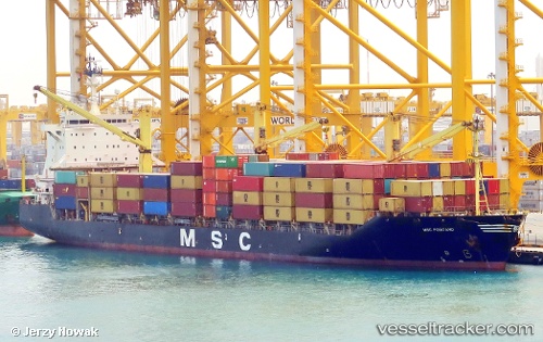
Vessel MSC POSITANO IMO: 9154191, MMSI: 636018319 Container Ship
UTC, 26.83706, 51.01774, course: -1, speed: 13.6
UTC, 26.79548, 50.55875, course: -1, speed: 12.7
2026-01-18 07:53:47 UTC, 26.78345, 50.45652, course: -1, speed: 13.4
Live AIS position:
UTC. 17 nm NE of Ras Tannurah),
updated 2026-01-18 07:53:47 UTC.
Find the position of the vessel MSC POSITANO on the map. The latter are known coordinates and path.
marine traffic ship tracker show on live map
The current position of vessel MSC POSITANO is 26.78345 lat / 50.45652 lng. Updated: 2026-01-18 07:53:47 UTCCurrently sailing under the flag of Liberia
MSC POSITANO built in 1997 year
Deadweight:
34083 tDetails:
Last coordinates of the vessel:
UTC, 26.54592, 51.38784, course: -1, speed: 13.6UTC, 26.83706, 51.01774, course: -1, speed: 13.6
UTC, 26.79548, 50.55875, course: -1, speed: 12.7
2026-01-18 07:53:47 UTC, 26.78345, 50.45652, course: -1, speed: 13.4