 vesseltracker.com
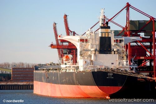
Vessel Rutland IMO: 9472282, MMSI: 636018375 Bulk Carrier
UTC, 38.97698, 117.76591, course: 355, speed: 0
UTC, 38.97701, 117.76596, course: 355, speed: 0
2026-01-13 14:54:36 UTC, 38.97697, 117.76590, course: 355, speed: 0
Live AIS position:
UTC. Near Tianjin Pt),
updated 2026-01-13 14:54:36 UTC.
Find the position of the vessel Rutland on the map. The latter are known coordinates and path.
marine traffic ship tracker show on live map
The current position of vessel Rutland is 38.97697 lat / 117.76590 lng. Updated: 2026-01-13 14:54:36 UTCCurrently sailing under the flag of Liberia
Rutland built in 2009 year
Deadweight:
178031 tDetails:
Last coordinates of the vessel:
UTC, 38.97669, 117.76605, course: 355, speed: 0UTC, 38.97698, 117.76591, course: 355, speed: 0
UTC, 38.97701, 117.76596, course: 355, speed: 0
2026-01-13 14:54:36 UTC, 38.97697, 117.76590, course: 355, speed: 0