 vesseltracker.com
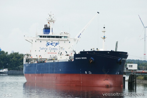
Vessel Anichkov Bridge IMO: 9256901, MMSI: 636018400 Chemical Oil Products Tanker
UTC, 25.17577, 56.45373, course: 332, speed: 0
UTC, 25.17559, 56.45373, course: 337, speed: 0.1
2026-02-17 20:21:14 UTC, 25.17559, 56.45338, course: 350, speed: 0
Live AIS position:
UTC. Near Fujairah),
updated 2026-02-17 20:21:14 UTC.
Find the position of the vessel Anichkov Bridge on the map. The latter are known coordinates and path.
marine traffic ship tracker show on live map
The current position of vessel Anichkov Bridge is 25.17559 lat / 56.45338 lng. Updated: 2026-02-17 20:21:14 UTCCurrently sailing under the flag of Liberia
Anichkov Bridge built in 2003 year
Deadweight:
47842 tDetails:
Last coordinates of the vessel:
UTC, 25.17582, 56.45377, course: 16, speed: 0.1UTC, 25.17577, 56.45373, course: 332, speed: 0
UTC, 25.17559, 56.45373, course: 337, speed: 0.1
2026-02-17 20:21:14 UTC, 25.17559, 56.45338, course: 350, speed: 0