 vesseltracker.com
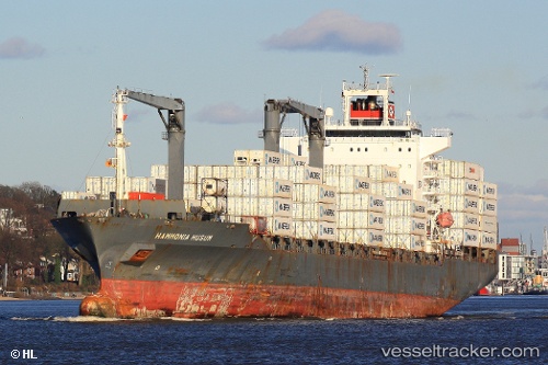
Vessel Hammonia Husum IMO: 9326835, MMSI: 636018561 Container Ship
UTC, 12.56438, -72.78135, course: 250, speed: 10.3
UTC, 12.52018, -72.89387, course: 247, speed: 10.1
2026-01-15 17:47:52 UTC, 12.42419, -73.13055, course: 246, speed: 10.7
Live AIS position:
UTC. 57 nm NW of Manaure),
updated 2026-01-15 17:47:52 UTC.
Find the position of the vessel Hammonia Husum on the map. The latter are known coordinates and path.
marine traffic ship tracker show on live map
The current position of vessel Hammonia Husum is 12.42419 lat / -73.13055 lng. Updated: 2026-01-15 17:47:52 UTCDetails:
Last coordinates of the vessel:
UTC, 12.64696, -72.57663, course: 243, speed: 10.9UTC, 12.56438, -72.78135, course: 250, speed: 10.3
UTC, 12.52018, -72.89387, course: 247, speed: 10.1
2026-01-15 17:47:52 UTC, 12.42419, -73.13055, course: 246, speed: 10.7