 vesseltracker.com
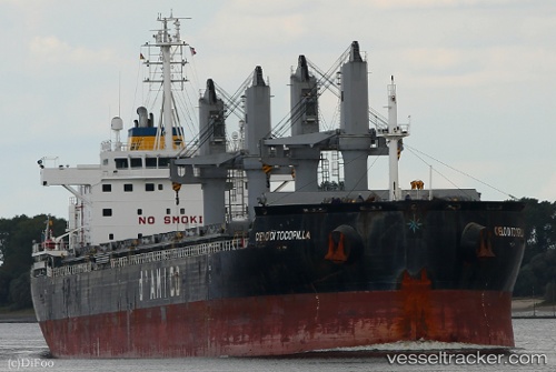
Vessel Cielo Di Tocopilla IMO: 9638159, MMSI: 636018592 Bulk Carrier
UTC, 27.63672, -82.56332, course: 5, speed: 0
UTC, 27.63673, -82.56330, course: 5, speed: 0
2026-01-29 01:34:43 UTC, 27.63672, -82.56331, course: 5, speed: 0
Live AIS position:
UTC. Near Port Manatee),
updated 2026-01-29 01:34:43 UTC.
Find the position of the vessel Cielo Di Tocopilla on the map. The latter are known coordinates and path.
marine traffic ship tracker show on live map
The current position of vessel Cielo Di Tocopilla is 27.63672 lat / -82.56331 lng. Updated: 2026-01-29 01:34:43 UTCCurrently sailing under the flag of Liberia
Details:
Last coordinates of the vessel:
UTC, 27.63674, -82.56333, course: 6, speed: 0UTC, 27.63672, -82.56332, course: 5, speed: 0
UTC, 27.63673, -82.56330, course: 5, speed: 0
2026-01-29 01:34:43 UTC, 27.63672, -82.56331, course: 5, speed: 0