 vesseltracker.com
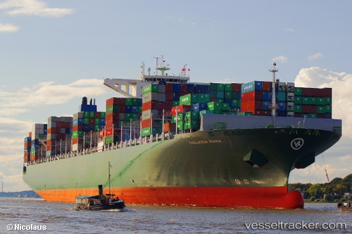
Vessel Thalassa Mana IMO: 9667150, MMSI: 636018700 Container Ship
UTC, 51.94877, 4.05850, course: 80, speed: 0
UTC, 51.94879, 4.05871, course: 79, speed: 0
2026-02-22 01:55:55 UTC, 51.94875, 4.05855, course: 79, speed: 0
Live AIS position:
UTC. Near MAASVLAKTE - ROTTERDAM),
updated 2026-02-22 01:55:55 UTC.
Find the position of the vessel Thalassa Mana on the map. The latter are known coordinates and path.
marine traffic ship tracker show on live map
The current position of vessel Thalassa Mana is 51.94875 lat / 4.05855 lng. Updated: 2026-02-22 01:55:55 UTCCurrently sailing under the flag of Liberia
Thalassa Mana built in 2014 year
Deadweight:
131862 tDetails:
Last coordinates of the vessel:
UTC, 51.94841, 4.05817, course: 79, speed: 0UTC, 51.94877, 4.05850, course: 80, speed: 0
UTC, 51.94879, 4.05871, course: 79, speed: 0
2026-02-22 01:55:55 UTC, 51.94875, 4.05855, course: 79, speed: 0