 vesseltracker.com
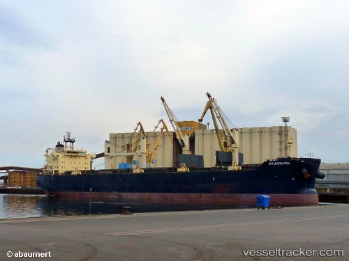
Vessel Star Bright IMO: 9507788, MMSI: 636018927 Bulk Carrier
UTC, 16.97062, 82.28286, course: 190, speed: 0
UTC, 16.97064, 82.28288, course: 190, speed: 0
2026-03-10 05:20:21 UTC, 16.97060, 82.28291, course: 190, speed: 0
Live Vessel Star Bright Analytics (details, animations, etc.)
Live AIS position: UTC. Near Kakinada), updated 2026-03-10 05:20:21 UTC.Find the position of the vessel Star Bright on the map. The latter are known coordinates and path.
marine traffic ship tracker show on live map
The current position of vessel Star Bright is 16.97060 lat / 82.28291 lng. Updated: 2026-03-10 05:20:21 UTCCurrently sailing under the flag of Liberia
Star Bright built in 2010 year
Deadweight:
55783 tDetails:
Last coordinates of the vessel:
UTC, 16.97060, 82.28284, course: -1, speed: 0UTC, 16.97062, 82.28286, course: 190, speed: 0
UTC, 16.97064, 82.28288, course: 190, speed: 0
2026-03-10 05:20:21 UTC, 16.97060, 82.28291, course: 190, speed: 0