 vesseltracker.com
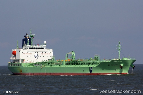
Vessel RADIANT RAY IMO: 9749697, MMSI: 636019178 Chemical/Oil Products Tanker
UTC, 53.69179, 9.50001, course: 345, speed: 13.9
UTC, 53.86196, 8.74211, course: 310, speed: 13.6
2026-03-02 19:35:49 UTC, 53.98535, 8.40982, course: 282, speed: 8.5
Live AIS position:
UTC. 13 nm NW of Cuxhaven),
updated 2026-03-02 19:35:49 UTC.
Find the position of the vessel RADIANT RAY on the map. The latter are known coordinates and path.
marine traffic ship tracker show on live map
The current position of vessel RADIANT RAY is 53.98535 lat / 8.40982 lng. Updated: 2026-03-02 19:35:49 UTCCurrently sailing under the flag of Liberia
RADIANT RAY built in 2018 year
Deadweight:
19974 tDetails:
Last coordinates of the vessel:
UTC, 53.53607, 10.00778, course: 281, speed: 0UTC, 53.69179, 9.50001, course: 345, speed: 13.9
UTC, 53.86196, 8.74211, course: 310, speed: 13.6
2026-03-02 19:35:49 UTC, 53.98535, 8.40982, course: 282, speed: 8.5