 vesseltracker.com
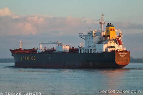
Vessel High Voyager IMO: 9681845, MMSI: 636019233 Chemical Oil Products Tanker
UTC, 1.18721, 103.75311, course: 120, speed: 0.2
UTC, 1.18716, 103.75293, course: 127, speed: 0.1
2026-01-29 15:35:32 UTC, 1.18732, 103.75304, course: 125, speed: 0.3
Live AIS position:
UTC. Near BUKOM ISLAND),
updated 2026-01-29 15:35:32 UTC.
Find the position of the vessel High Voyager on the map. The latter are known coordinates and path.
marine traffic ship tracker show on live map
The current position of vessel High Voyager is 1.18732 lat / 103.75304 lng. Updated: 2026-01-29 15:35:32 UTCDetails:
Last coordinates of the vessel:
UTC, 1.18688, 103.75243, course: 104, speed: 0.1UTC, 1.18721, 103.75311, course: 120, speed: 0.2
UTC, 1.18716, 103.75293, course: 127, speed: 0.1
2026-01-29 15:35:32 UTC, 1.18732, 103.75304, course: 125, speed: 0.3