 vesseltracker.com
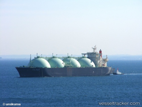
Vessel LNG VESTA IMO: 9020766, MMSI: 636020066 LNG Tanker
UTC, 17.86606, -76.78103, course: 65, speed: 0
UTC, 17.86793, -76.78097, course: 125, speed: 0
2026-01-16 06:52:40 UTC, 17.86783, -76.78115, course: 127, speed: 0.1
Live AIS position:
UTC. Near Kingston),
updated 2026-01-16 06:52:40 UTC.
Find the position of the vessel LNG VESTA on the map. The latter are known coordinates and path.
marine traffic ship tracker show on live map
The current position of vessel LNG VESTA is 17.86783 lat / -76.78115 lng. Updated: 2026-01-16 06:52:40 UTCCurrently sailing under the flag of Liberia
LNG VESTA built in 1994 year
Deadweight:
68522 tDetails:
Last coordinates of the vessel:
UTC, 17.86815, -76.78112, course: 131, speed: 0UTC, 17.86606, -76.78103, course: 65, speed: 0
UTC, 17.86793, -76.78097, course: 125, speed: 0
2026-01-16 06:52:40 UTC, 17.86783, -76.78115, course: 127, speed: 0.1