 vesseltracker.com
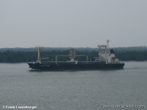
Vessel EASTERN HARMONY IMO: 9517006, MMSI: 636020237 General Cargo Ship
UTC, 39.04894, 117.76626, course: 292, speed: 0
UTC, 39.04897, 117.76629, course: -1, speed: 0
2026-03-09 17:44:39 UTC, 39.04892, 117.76622, course: 292, speed: 0
Live Vessel EASTERN HARMONY Analytics (details, animations, etc.)
Live AIS position: UTC. Near Tianjin Pt), updated 2026-03-09 17:44:39 UTC.Find the position of the vessel EASTERN HARMONY on the map. The latter are known coordinates and path.
marine traffic ship tracker show on live map
The current position of vessel EASTERN HARMONY is 39.04892 lat / 117.76622 lng. Updated: 2026-03-09 17:44:39 UTCCurrently sailing under the flag of Liberia
EASTERN HARMONY built in 2009 year
Deadweight:
12000 tDetails:
Last coordinates of the vessel:
UTC, 39.04897, 117.76626, course: 292, speed: 0UTC, 39.04894, 117.76626, course: 292, speed: 0
UTC, 39.04897, 117.76629, course: -1, speed: 0
2026-03-09 17:44:39 UTC, 39.04892, 117.76622, course: 292, speed: 0