 vesseltracker.com
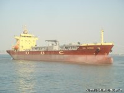
Vessel BLUE CIMENT 3 IMO: 9577276, MMSI: 636020381 Cement Carrier
UTC, 38.02977, 23.49478, course: 41, speed: 0
UTC, 38.02976, 23.49482, course: 41, speed: 0
2026-02-27 18:14:05 UTC, 38.02981, 23.49478, course: 41, speed: 0
Live AIS position:
UTC. Near Eleusis),
updated 2026-02-27 18:14:05 UTC.
Find the position of the vessel BLUE CIMENT 3 on the map. The latter are known coordinates and path.
marine traffic ship tracker show on live map
The current position of vessel BLUE CIMENT 3 is 38.02981 lat / 23.49478 lng. Updated: 2026-02-27 18:14:05 UTCCurrently sailing under the flag of Liberia
BLUE CIMENT 3 built in 2010 year
Deadweight:
15053 tDetails:
Last coordinates of the vessel:
UTC, 38.02982, 23.49482, course: 41, speed: 0UTC, 38.02977, 23.49478, course: 41, speed: 0
UTC, 38.02976, 23.49482, course: 41, speed: 0
2026-02-27 18:14:05 UTC, 38.02981, 23.49478, course: 41, speed: 0