 vesseltracker.com
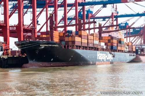
Vessel '636020939' IMO: 9243198, MMSI: 636020939
UTC, 26.15412, 52.86280, course: 91, speed: 12
UTC, 26.11779, 53.22644, course: 97, speed: 12
2026-01-18 09:27:03 UTC, 26.11779, 53.22644, course: 97, speed: 12
Live AIS position:
UTC. 38 nm N of Abu al Bukhoosh),
updated 2026-01-18 09:27:03 UTC.
Find the position of the vessel '636020939' on the map. The latter are known coordinates and path.
marine traffic ship tracker show on live map
The current position of vessel '636020939' is 26.11779 lat / 53.22644 lng. Updated: 2026-01-18 09:27:03 UTCDetails:
Last coordinates of the vessel:
UTC, 26.15463, 52.78782, course: 91, speed: 12.1UTC, 26.15412, 52.86280, course: 91, speed: 12
UTC, 26.11779, 53.22644, course: 97, speed: 12
2026-01-18 09:27:03 UTC, 26.11779, 53.22644, course: 97, speed: 12