 vesseltracker.com
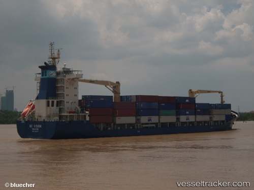
Vessel VALENCIA ELIZABETH D IMO: 9332717, MMSI: 636021231 Container Ship
UTC, 40.48523, 28.36593, course: 106, speed: 9.3
UTC, 40.46115, 28.45407, course: 105, speed: 8.8
2026-01-17 05:30:33 UTC, 40.44467, 28.81596, course: 94, speed: 9.6
Live AIS position:
UTC. Near Mudanya),
updated 2026-01-17 05:30:33 UTC.
Find the position of the vessel VALENCIA ELIZABETH D on the map. The latter are known coordinates and path.
marine traffic ship tracker show on live map
The current position of vessel VALENCIA ELIZABETH D is 40.44467 lat / 28.81596 lng. Updated: 2026-01-17 05:30:33 UTCCurrently sailing under the flag of Liberia
VALENCIA ELIZABETH D built in 2006 year
Deadweight:
13797 tDetails:
Last coordinates of the vessel:
UTC, 40.58284, 28.08794, course: 105, speed: 8.4UTC, 40.48523, 28.36593, course: 106, speed: 9.3
UTC, 40.46115, 28.45407, course: 105, speed: 8.8
2026-01-17 05:30:33 UTC, 40.44467, 28.81596, course: 94, speed: 9.6