 vesseltracker.com
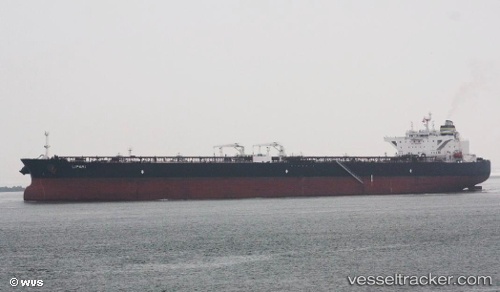
Vessel LIPARI IMO: 9529487, MMSI: 636021781 Crude Oil Tanker
UTC, 37.56515, -1.02174, course: 230, speed: 0.2
UTC, 37.56543, -1.02190, course: 229, speed: 0.1
2026-02-05 17:59:32 UTC, 37.56549, -1.02199, course: 227, speed: 0.1
Live AIS position:
UTC. Near Cartagena),
updated 2026-02-05 17:59:32 UTC.
Find the position of the vessel LIPARI on the map. The latter are known coordinates and path.
marine traffic ship tracker show on live map
The current position of vessel LIPARI is 37.56549 lat / -1.02199 lng. Updated: 2026-02-05 17:59:32 UTCCurrently sailing under the flag of Liberia
LIPARI built in 2012 year
Deadweight:
158237 tDetails:
Last coordinates of the vessel:
UTC, 37.56486, -1.02229, course: 227, speed: 0.1UTC, 37.56515, -1.02174, course: 230, speed: 0.2
UTC, 37.56543, -1.02190, course: 229, speed: 0.1
2026-02-05 17:59:32 UTC, 37.56549, -1.02199, course: 227, speed: 0.1