vessel ANNIE IMO: 9307061, Bulk Carrier vesseltracker.com
Vessel ANNIE IMO: 9307061, Bulk Carrier
MMSI: 636021808 callsign: 5LFU2 size: 45x289

Find the position of the vessel ANNIE on the map. The latter are known coordinates and path.

marine traffic ship tracker show on live map

The current position of vessel ANNIE is 34.5583 lat / 123.012 lng. Updated: 2025-03-29 13:20:29 UTC

Currently sailing under the flag of Liberia

ANNIE built in 2006 year

Port of registry:
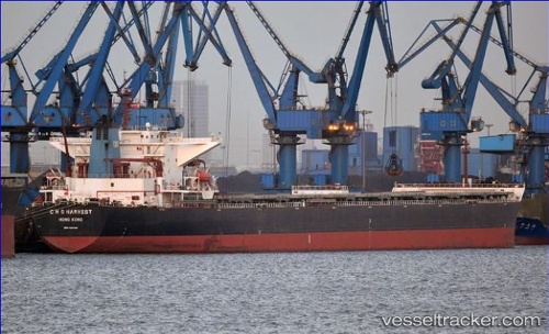
Hong Kong (city and special administrative region of China)
Deadweight:
173624 t

Payload_mass:
173624 tonne
Gross tonnage:
89659
Service entry:
2006-01-01T00:00:00Z
Details:


Last coordinates of the vessel:
UTC, 34.6383, 122.715, course: -1, speed: 7
UTC, 34.6117, 122.812, course: -1, speed: 7
UTC, 34.5883, 122.908, course: -1, speed: 7
2025-03-29 13:20:29 UTC, 34.5583, 123.012, course: -1, speed: 6

Track of the vessel in the last 14 days


Most frequent ports a vessels calls at ANNIE (636021808):

Richards Bay, traffic: 8
Port Headland, traffic: 6
Port Hedland, traffic: 5
Selat Lombok, traffic: 5
Wusong, traffic: 4
Bur Ibrahim, traffic: 4
Port Said, traffic: 4
Wu-Sung, traffic: 4
BATU AMPAR, traffic: 3
Sambu, traffic: 3
Muara Pantai, traffic: 3
TANAH MERAH, traffic: 3
Trincomalee, traffic: 3
Uskudar, traffic: 3
SUEZ PORT, traffic: 2

Link to the map:


Find another ship

ANNIE (636021808) last ports (portcalls and passsages)

Rizhao | 2025-03-24 17:55:04
TANAH MERAH | 2025-03-07 00:32:49
BATU AMPAR | 2025-03-07 00:06:14
PULAU SAMBU | 2025-03-06 23:16:10
RAS SHUKHEIR | 2025-02-11 05:45:08
Ayn Sukhnah | 2025-02-10 19:51:12
AL ADABIYAH | 2025-02-10 17:32:52
SUEZ PORT | 2025-02-10 16:44:28
SUEZ CANAL | 2025-02-10 14:59:22
ISMAILIA | 2025-02-10 13:04:43
Port Said | 2025-02-10 07:22:01
Canakkale | 2025-02-06 14:04:32
Gelibolu | 2025-02-06 12:26:57
Ambarli | 2025-02-05 11:48:23
BAKIRKOY | 2025-02-05 09:07:54
RUMELI FENERI | 2025-02-05 07:14:24
RUMELI FENERI | 2025-01-19 15:00:26
Istanbul | 2025-01-19 13:19:06
BAKIRKOY | 2025-01-19 12:13:00
SARAYLAR | 2025-01-18 18:34:14
Gelibolu | 2025-01-18 14:11:45
Canakkale | 2025-01-18 12:14:11
Port Said | 2025-01-13 14:28:35
ISMAILIA | 2025-01-13 10:54:16
SUEZ CANAL | 2025-01-13 08:52:19
Bur Ibrahim | 2025-01-13 04:57:45
BATU AMPAR | 2024-12-25 15:50:35
TANAH MERAH | 2024-12-25 15:28:13
JINGTANG | 2024-12-09 11:05:49
TANAH MERAH | 2024-11-22 03:00:46
BATU AMPAR | 2024-11-22 01:24:05
Sambu | 2024-11-22 00:36:48
BUKOM ISLAND | 2024-11-21 23:50:11
Ra’S Shukhayr | 2024-11-01 05:54:56
Bur Ibrahim | 2024-10-31 17:30:38
Port Said | 2024-10-31 07:14:27
Iskenderun | 2024-10-19 05:02:49
Port Said | 2024-10-17 13:43:23
Bur Ibrahim | 2024-10-17 03:18:39
New Mangalore | 2024-09-28 04:14:59
Muara Pantai | 2024-09-13 16:10:55
Muara Pantai | 2024-09-09 14:59:26
Muara Pantai | 2024-09-05 14:10:27
Richards Bay | 2024-04-14 11:45:47
Trincomalee | 2024-02-20 17:08:48
Richards Bay | 2024-01-24 06:47:12
Richards Bay | 2023-11-23 11:14:58
Trincomalee | 2023-10-18 22:19:04
Richards Bay | 2023-09-26 18:27:28
Richards Bay | 2023-09-22 18:23:18
Trincomalee | 2023-08-21 08:08:47
Richards Bay | 2023-08-01 06:29:36
Richards Bay | 2023-07-28 05:24:40
Singapore | 2023-06-30 03:14:49
Sambu | 2023-06-05 02:56:48
Paradip | 2023-05-26 03:25:54
Richards Bay | 2023-04-23 19:04:12
Kao-Hsiung Kang | 2023-02-18 03:02:39
Kaohsiung | 2023-02-17 20:46:59
Newcastle | 2023-01-03 08:25:55
Selat Lombok | 2022-04-04 17:30:49
Port Hedland | 2022-03-31 18:46:23
Wu-Sung | 2022-03-17 11:59:50
Lianyungang | 2022-03-07 08:52:33
Port Hedland | 2022-02-06 00:00:57
Selat Lombok | 2022-01-18 20:19:32
Wu-Sung | 2022-01-07 20:46:21
Selat Lombok | 2021-12-21 09:16:55
Port Headland | 2021-12-17 05:55:55