 vesseltracker.com
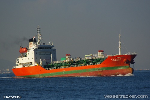
Vessel ORIS MARINE IMO: 9179488, MMSI: 636021826 Chemical/Oil Products Tanker
UTC, 34.90251, 35.84361, course: 164, speed: 0
UTC, 34.90251, 35.84361, course: 164, speed: 0
2026-01-17 05:15:43 UTC, 34.90161, 35.84232, course: 80, speed: 0
Live AIS position:
UTC. Near Tartous),
updated 2026-01-17 05:15:43 UTC.
Find the position of the vessel ORIS MARINE on the map. The latter are known coordinates and path.
marine traffic ship tracker show on live map
The current position of vessel ORIS MARINE is 34.90161 lat / 35.84232 lng. Updated: 2026-01-17 05:15:43 UTCCurrently sailing under the flag of Liberia
ORIS MARINE built in 1998 year
Deadweight:
3522 tDetails:
Last coordinates of the vessel:
UTC, 34.90251, 35.84361, course: 164, speed: 0UTC, 34.90251, 35.84361, course: 164, speed: 0
UTC, 34.90251, 35.84361, course: 164, speed: 0
2026-01-17 05:15:43 UTC, 34.90161, 35.84232, course: 80, speed: 0