 vesseltracker.com
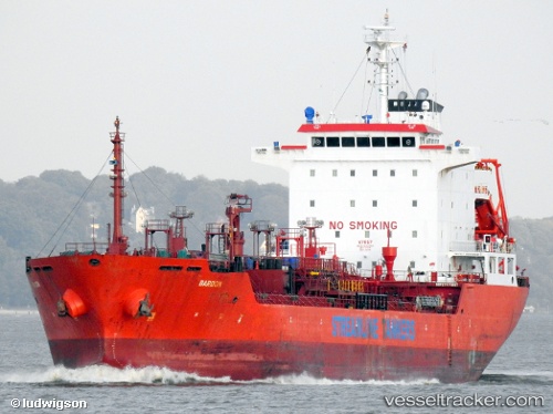
Vessel K ONSET IMO: 9359595, MMSI: 636022087 Chemical/Oil Products Tanker
UTC, 42.29533, 41.51367, course: 93, speed: 9.3
UTC, 42.27400, 41.63967, course: -1, speed: 0
2026-03-10 05:57:57 UTC, 42.27400, 41.63967, course: -1, speed: 0
Live Vessel K ONSET Analytics (details, animations, etc.)
Live AIS position: UTC. Near KULEVI), updated 2026-03-10 05:57:57 UTC.Find the position of the vessel K ONSET on the map. The latter are known coordinates and path.
marine traffic ship tracker show on live map
The current position of vessel K ONSET is 42.27400 lat / 41.63967 lng. Updated: 2026-03-10 05:57:57 UTCCurrently sailing under the flag of Liberia
K ONSET built in 2006 year
Deadweight:
12902 tDetails:
Last coordinates of the vessel:
UTC, 42.18917, 41.60350, course: 142, speed: 0.1UTC, 42.29533, 41.51367, course: 93, speed: 9.3
UTC, 42.27400, 41.63967, course: -1, speed: 0
2026-03-10 05:57:57 UTC, 42.27400, 41.63967, course: -1, speed: 0