 vesseltracker.com
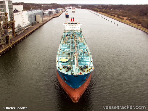
Vessel ROSE I IMO: 9376945, MMSI: 636022191 Chemical/Oil Products Tanker
UTC, 37.85654, 23.53376, course: 212, speed: 0.1
UTC, 37.85410, 23.53452, course: 303, speed: 0.1
2026-01-30 00:22:54 UTC, 37.85421, 23.53554, course: 282, speed: 0.2
Live AIS position:
UTC. Near SOUVALA),
updated 2026-01-30 00:22:54 UTC.
Find the position of the vessel ROSE I on the map. The latter are known coordinates and path.
marine traffic ship tracker show on live map
The current position of vessel ROSE I is 37.85421 lat / 23.53554 lng. Updated: 2026-01-30 00:22:54 UTCCurrently sailing under the flag of Liberia
ROSE I built in 2007 year
Deadweight:
37900 tDetails:
Last coordinates of the vessel:
UTC, 37.85645, 23.53227, course: 166, speed: 0.1UTC, 37.85654, 23.53376, course: 212, speed: 0.1
UTC, 37.85410, 23.53452, course: 303, speed: 0.1
2026-01-30 00:22:54 UTC, 37.85421, 23.53554, course: 282, speed: 0.2