 vesseltracker.com
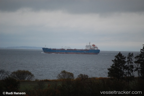
Vessel KINGSTON IMO: 9420863, MMSI: 636022950 Chemical Oil Products Tanker
UTC, 44.27024, 37.50098, course: 73, speed: 11.9
UTC, 44.32034, 37.59219, course: 320, speed: 1.2
2026-01-31 13:24:20 UTC, 44.35723, 37.62507, course: 319, speed: 1.3
Live AIS position:
UTC. 19 nm S of Cpc Terminal),
updated 2026-01-31 13:24:20 UTC.
Find the position of the vessel KINGSTON on the map. The latter are known coordinates and path.
marine traffic ship tracker show on live map
The current position of vessel KINGSTON is 44.35723 lat / 37.62507 lng. Updated: 2026-01-31 13:24:20 UTCCurrently sailing under the flag of Liberia
KINGSTON built in 2009 year
Deadweight:
38349 tDetails:
Last coordinates of the vessel:
UTC, 44.20612, 37.10402, course: 77, speed: 12.8UTC, 44.27024, 37.50098, course: 73, speed: 11.9
UTC, 44.32034, 37.59219, course: 320, speed: 1.2
2026-01-31 13:24:20 UTC, 44.35723, 37.62507, course: 319, speed: 1.3