 vesseltracker.com
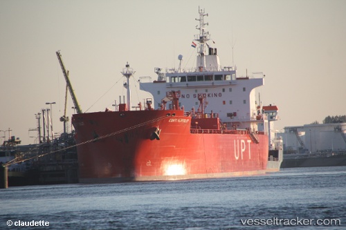
Vessel BRONX IMO: 9391414, MMSI: 636022962 Crude Oil Tanker
UTC, 32.12019, 19.96706, course: -1, speed: 0.1
UTC, 32.12039, 19.96759, course: -1, speed: 0.1
2026-02-09 14:19:31 UTC, 32.11993, 19.96813, course: -1, speed: 0.2
Live AIS position:
UTC. Near BENGHAZI),
updated 2026-02-09 14:19:31 UTC.
Find the position of the vessel BRONX on the map. The latter are known coordinates and path.
marine traffic ship tracker show on live map
The current position of vessel BRONX is 32.11993 lat / 19.96813 lng. Updated: 2026-02-09 14:19:31 UTCCurrently sailing under the flag of Liberia
BRONX built in 2008 year
Deadweight:
37602 tDetails:
Last coordinates of the vessel:
UTC, 32.11799, 20.04024, course: -1, speed: 4.1UTC, 32.12019, 19.96706, course: -1, speed: 0.1
UTC, 32.12039, 19.96759, course: -1, speed: 0.1
2026-02-09 14:19:31 UTC, 32.11993, 19.96813, course: -1, speed: 0.2