 vesseltracker.com
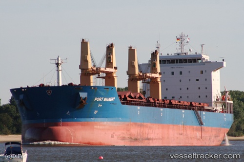
Vessel MAUBERT IMO: 9358864, MMSI: 636023451 Bulk Carrier
UTC, 29.83912, 32.58575, course: 334, speed: 0
UTC, 29.83926, 32.58588, course: 327, speed: 0
2026-02-24 00:10:20 UTC, 29.83921, 32.58366, course: 38, speed: 0.1
Live AIS position:
UTC. Near Bur Ibrahim),
updated 2026-02-24 00:10:20 UTC.
Find the position of the vessel MAUBERT on the map. The latter are known coordinates and path.
marine traffic ship tracker show on live map
The current position of vessel MAUBERT is 29.83921 lat / 32.58366 lng. Updated: 2026-02-24 00:10:20 UTCCurrently sailing under the flag of Liberia
Details:
Last coordinates of the vessel:
UTC, 29.83951, 32.58606, course: 310, speed: 0UTC, 29.83912, 32.58575, course: 334, speed: 0
UTC, 29.83926, 32.58588, course: 327, speed: 0
2026-02-24 00:10:20 UTC, 29.83921, 32.58366, course: 38, speed: 0.1