 vesseltracker.com
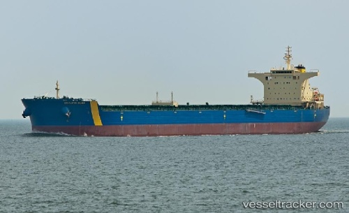
Vessel EASTERN VERONICA IMO: 9435064, MMSI: 636023687 Bulk Carrier
UTC, 21.18124, 111.61779, course: 78, speed: 9.3
UTC, 21.22544, 111.91761, course: 74, speed: 9
2026-03-09 20:12:21 UTC, 21.31931, 112.30899, course: 72, speed: 9.2
Live Vessel EASTERN VERONICA Analytics (details, animations, etc.)
Live AIS position: UTC. 24 nm S of Dongping), updated 2026-03-09 20:12:21 UTC.Find the position of the vessel EASTERN VERONICA on the map. The latter are known coordinates and path.
marine traffic ship tracker show on live map
The current position of vessel EASTERN VERONICA is 21.31931 lat / 112.30899 lng. Updated: 2026-03-09 20:12:21 UTCCurrently sailing under the flag of Liberia
Details:
Last coordinates of the vessel:
UTC, 21.12876, 111.38033, course: 75, speed: 9.9UTC, 21.18124, 111.61779, course: 78, speed: 9.3
UTC, 21.22544, 111.91761, course: 74, speed: 9
2026-03-09 20:12:21 UTC, 21.31931, 112.30899, course: 72, speed: 9.2