 vesseltracker.com
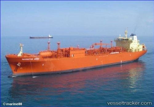
Vessel NAVIGATOR ARIES IMO: 9403762, MMSI: 636025003 Lpg Tanker
UTC, 24.78813, 67.27935, course: 120, speed: 0.1
UTC, 24.78816, 67.27933, course: 120, speed: 0
2026-03-11 16:05:15 UTC, 24.78810, 67.27935, course: -1, speed: 0
Live Vessel NAVIGATOR ARIES Analytics (details, animations, etc.)
Live AIS position: UTC. Near PORT QASIM), updated 2026-03-11 16:05:15 UTC.Find the position of the vessel NAVIGATOR ARIES on the map. The latter are known coordinates and path.
marine traffic ship tracker show on live map
The current position of vessel NAVIGATOR ARIES is 24.78810 lat / 67.27935 lng. Updated: 2026-03-11 16:05:15 UTCCurrently sailing under the flag of Liberia
Details:
Last coordinates of the vessel:
UTC, 24.78816, 67.27932, course: -1, speed: 0UTC, 24.78813, 67.27935, course: 120, speed: 0.1
UTC, 24.78816, 67.27933, course: 120, speed: 0
2026-03-11 16:05:15 UTC, 24.78810, 67.27935, course: -1, speed: 0