 vesseltracker.com
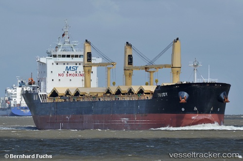
Vessel Trudy IMO: 9415246, MMSI: 636091888 Bulk Carrier
UTC, 1.26669, 103.68634, course: -1, speed: 0
2026-02-03 21:23:33 UTC, 1.26669, 103.68634, course: -1, speed: 0
Live AIS position:
UTC. Near JURONG ISLAND),
updated 2026-02-03 21:23:33 UTC.
Find the position of the vessel Trudy on the map. The latter are known coordinates and path.
marine traffic ship tracker show on live map
The current position of vessel Trudy is 1.26669 lat / 103.68634 lng. Updated: 2026-02-03 21:23:33 UTCCurrently sailing under the flag of Liberia
Trudy built in 2009 year
Deadweight:
30790 tDetails:
Last coordinates of the vessel:
UTC, 1.26669, 103.68634, course: -1, speed: 0UTC, 1.26669, 103.68634, course: -1, speed: 0
2026-02-03 21:23:33 UTC, 1.26669, 103.68634, course: -1, speed: 0