 vesseltracker.com
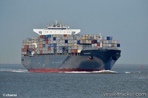
Vessel Tempanos IMO: 9447897, MMSI: 636092780 Container Ship
UTC, 22.45320, 113.89251, course: 37, speed: 0
UTC, 22.45322, 113.89247, course: 37, speed: 0
2026-03-05 13:31:14 UTC, 22.45313, 113.89248, course: 38, speed: 0
Live Vessel Tempanos Analytics (details, animations, etc.)
Live AIS position: UTC. Near Mawan Pt), updated 2026-03-05 13:31:14 UTC.Find the position of the vessel Tempanos on the map. The latter are known coordinates and path.
marine traffic ship tracker show on live map
The current position of vessel Tempanos is 22.45313 lat / 113.89248 lng. Updated: 2026-03-05 13:31:14 UTCCurrently sailing under the flag of Liberia
Tempanos built in 2011 year
Deadweight:
94649 tDetails:
Last coordinates of the vessel:
UTC, 22.45310, 113.89247, course: 36, speed: 0UTC, 22.45320, 113.89251, course: 37, speed: 0
UTC, 22.45322, 113.89247, course: 37, speed: 0
2026-03-05 13:31:14 UTC, 22.45313, 113.89248, course: 38, speed: 0