 vesseltracker.com
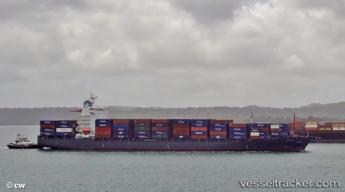
Vessel As Penelope IMO: 9294537, MMSI: 636092863 Container Ship
UTC, -0.23833, 106.63333, course: -1, speed: 13
UTC, -0.36167, 106.73167, course: -1, speed: 12
2026-01-15 18:51:27 UTC, -0.50890, 106.87998, course: 131, speed: 12.3
Live AIS position:
UTC. 105 nm NE of PANGKAL BALAM),
updated 2026-01-15 18:51:27 UTC.
Find the position of the vessel As Penelope on the map. The latter are known coordinates and path.
marine traffic ship tracker show on live map
The current position of vessel As Penelope is -0.50890 lat / 106.87998 lng. Updated: 2026-01-15 18:51:27 UTCCurrently sailing under the flag of Liberia
As Penelope built in 2005 year
Deadweight:
34740 tDetails:
Last coordinates of the vessel:
UTC, -0.11833, 106.54667, course: -1, speed: 13UTC, -0.23833, 106.63333, course: -1, speed: 13
UTC, -0.36167, 106.73167, course: -1, speed: 12
2026-01-15 18:51:27 UTC, -0.50890, 106.87998, course: 131, speed: 12.3