 vesseltracker.com
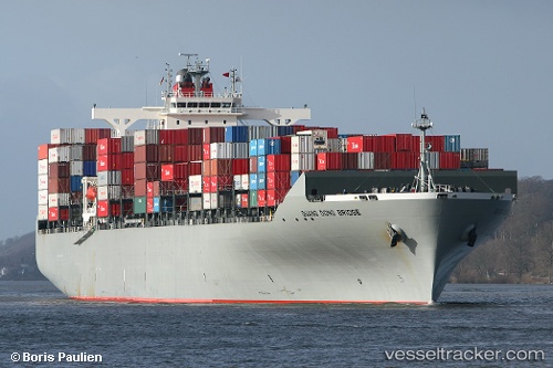
Vessel Guang Dong Bridge IMO: 9302102, MMSI: 636092911 Container Ship
UTC, 24.79710, 66.99040, course: 332, speed: 0
UTC, 24.50857, 66.98675, course: 87, speed: 3.6
2026-02-04 10:24:29 UTC, 24.70045, 67.14510, course: 10, speed: 9.8
Live AIS position:
UTC. 11 nm SW of PORT QASIM),
updated 2026-02-04 10:24:29 UTC.
Find the position of the vessel Guang Dong Bridge on the map. The latter are known coordinates and path.
marine traffic ship tracker show on live map
The current position of vessel Guang Dong Bridge is 24.70045 lat / 67.14510 lng. Updated: 2026-02-04 10:24:29 UTCCurrently sailing under the flag of Liberia
Guang Dong Bridge built in 2006 year
Deadweight:
71283 tDetails:
Last coordinates of the vessel:
UTC, 24.79713, 66.99042, course: 332, speed: 0UTC, 24.79710, 66.99040, course: 332, speed: 0
UTC, 24.50857, 66.98675, course: 87, speed: 3.6
2026-02-04 10:24:29 UTC, 24.70045, 67.14510, course: 10, speed: 9.8