 vesseltracker.com
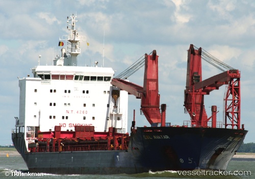
Vessel NORDIC KYLIE IMO: 9357999, MMSI: 636092982 General Cargo Ship
UTC, 29.70763, -89.98489, course: 327, speed: 0
UTC, 29.70781, -89.98467, course: 310, speed: 0
2026-02-21 16:30:17 UTC, 29.70820, -89.98436, course: 283, speed: 0
Live AIS position:
UTC. Near Wills Point),
updated 2026-02-21 16:30:17 UTC.
Find the position of the vessel NORDIC KYLIE on the map. The latter are known coordinates and path.
marine traffic ship tracker show on live map
The current position of vessel NORDIC KYLIE is 29.70820 lat / -89.98436 lng. Updated: 2026-02-21 16:30:17 UTCCurrently sailing under the flag of Liberia
NORDIC KYLIE built in 2005 year
Deadweight:
12760 tDetails:
Last coordinates of the vessel:
UTC, 29.70667, -89.98333, course: -1, speed: 0UTC, 29.70763, -89.98489, course: 327, speed: 0
UTC, 29.70781, -89.98467, course: 310, speed: 0
2026-02-21 16:30:17 UTC, 29.70820, -89.98436, course: 283, speed: 0