 vesseltracker.com
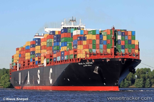
Vessel TANGIER EXPRESS IMO: 9525900, MMSI: 636093148 Container Ship
UTC, 39.25188, -76.54353, course: 307, speed: 0
UTC, 39.25186, -76.54353, course: 307, speed: 0
2026-03-24 17:43:06 UTC, 39.25186, -76.54352, course: 307, speed: 0
Live Vessel TANGIER EXPRESS Analytics (details, animations, etc.)
Live AIS position: UTC. Near DUNDALK), updated 2026-03-24 17:43:06 UTC.Find the position of the vessel TANGIER EXPRESS on the map. The latter are known coordinates and path.
marine traffic ship tracker show on live map
The current position of vessel TANGIER EXPRESS is 39.25186 lat / -76.54352 lng. Updated: 2026-03-24 17:43:06 UTCCurrently sailing under the flag of Liberia
Details:
Last coordinates of the vessel:
UTC, 39.25187, -76.54355, course: 307, speed: 0UTC, 39.25188, -76.54353, course: 307, speed: 0
UTC, 39.25186, -76.54353, course: 307, speed: 0
2026-03-24 17:43:06 UTC, 39.25186, -76.54352, course: 307, speed: 0