 vesseltracker.com
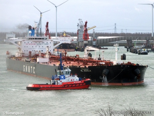
Vessel Al Agaila IMO: 9415404, MMSI: 642122016 Crude Oil Tanker
UTC, 36.86761, 35.94424, course: 172, speed: 0
UTC, 36.86771, 35.94455, course: 172, speed: 2.1
2026-02-01 11:26:55 UTC, 36.86762, 35.94426, course: 172, speed: 0
Live AIS position:
UTC. Near CEYHAN),
updated 2026-02-01 11:26:55 UTC.
Find the position of the vessel Al Agaila on the map. The latter are known coordinates and path.
marine traffic ship tracker show on live map
The current position of vessel Al Agaila is 36.86762 lat / 35.94426 lng. Updated: 2026-02-01 11:26:55 UTCCurrently sailing under the flag of Libya
Details:
Last coordinates of the vessel:
UTC, 36.86762, 35.94426, course: 172, speed: 0UTC, 36.86761, 35.94424, course: 172, speed: 0
UTC, 36.86771, 35.94455, course: 172, speed: 2.1
2026-02-01 11:26:55 UTC, 36.86762, 35.94426, course: 172, speed: 0