 vesseltracker.com
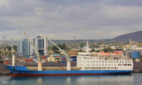
Vessel MAURITIUS TROCHETIA IMO: 9225287, MMSI: 645161000 Passenger/Cargo Ship
UTC, -20.15578, 57.49243, course: 119, speed: 0
UTC, -20.15580, 57.49242, course: 119, speed: 0
2026-03-25 01:38:34 UTC, -20.15574, 57.49241, course: 119, speed: 0
Live Vessel MAURITIUS TROCHETIA Analytics (details, animations, etc.)
Live AIS position: UTC. Near Port Louis), updated 2026-03-25 01:38:34 UTC.Find the position of the vessel MAURITIUS TROCHETIA on the map. The latter are known coordinates and path.
marine traffic ship tracker show on live map
The current position of vessel MAURITIUS TROCHETIA is -20.15574 lat / 57.49241 lng. Updated: 2026-03-25 01:38:34 UTCCurrently sailing under the flag of Mauritius
MAURITIUS TROCHETIA built in 2001 year
Deadweight:
3500 tDetails:
Last coordinates of the vessel:
UTC, -20.15581, 57.49244, course: 119, speed: 0UTC, -20.15578, 57.49243, course: 119, speed: 0
UTC, -20.15580, 57.49242, course: 119, speed: 0
2026-03-25 01:38:34 UTC, -20.15574, 57.49241, course: 119, speed: 0