 vesseltracker.com
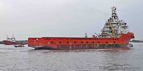
Vessel ANAIAH IMO: 9669988, MMSI: 657116400 Offshore Supply Ship
UTC, 3.65869, 5.84358, course: 104, speed: 4.6
UTC, 3.65511, 6.02454, course: 89, speed: 4.9
2026-01-19 11:24:01 UTC, 3.65833, 6.10500, course: -1, speed: 5
Live AIS position:
UTC. 27 nm SW of Brass River),
updated 2026-01-19 11:24:01 UTC.
Find the position of the vessel ANAIAH on the map. The latter are known coordinates and path.
marine traffic ship tracker show on live map
The current position of vessel ANAIAH is 3.65833 lat / 6.10500 lng. Updated: 2026-01-19 11:24:01 UTCCurrently sailing under the flag of Nigeria
ANAIAH built in 2014 year
Deadweight:
5114 tDetails:
Last coordinates of the vessel:
UTC, 3.66333, 5.74833, course: -1, speed: 5UTC, 3.65869, 5.84358, course: 104, speed: 4.6
UTC, 3.65511, 6.02454, course: 89, speed: 4.9
2026-01-19 11:24:01 UTC, 3.65833, 6.10500, course: -1, speed: 5