 vesseltracker.com
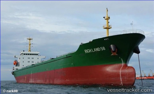
Vessel EN JI 17 IMO: 8653085, MMSI: 667002032 Bulk Carrier
UTC, 21.48519, 109.55349, course: 201, speed: 0
UTC, 21.48518, 109.55348, course: 201, speed: 0
2026-02-04 19:33:51 UTC, 21.48520, 109.55344, course: 201, speed: 0
Live AIS position:
UTC. Near Shitoubu Pt),
updated 2026-02-04 19:33:51 UTC.
Find the position of the vessel EN JI 17 on the map. The latter are known coordinates and path.
marine traffic ship tracker show on live map
The current position of vessel EN JI 17 is 21.48520 lat / 109.55344 lng. Updated: 2026-02-04 19:33:51 UTCCurrently sailing under the flag of Sierra leone
EN JI 17 built in 2006 year
Deadweight:
16552 tDetails:
Last coordinates of the vessel:
UTC, 21.48520, 109.55347, course: 201, speed: 0UTC, 21.48519, 109.55349, course: 201, speed: 0
UTC, 21.48518, 109.55348, course: 201, speed: 0
2026-02-04 19:33:51 UTC, 21.48520, 109.55344, course: 201, speed: 0