 vesseltracker.com
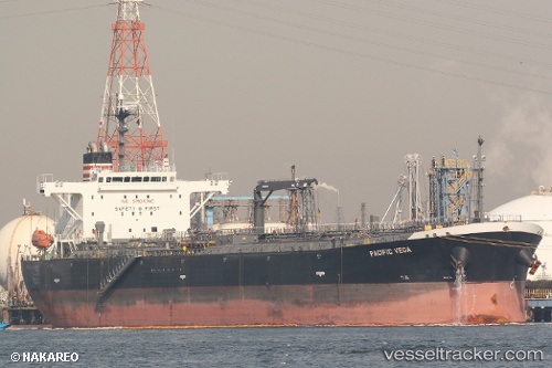
Vessel LERUO IMO: 9385831, MMSI: 667002320 Oil Products Tanker
UTC, 59.81188, 28.40662, course: 83, speed: 0
UTC, 59.81333, 28.40833, course: -1, speed: 0
2026-01-14 05:57:16 UTC, 59.81343, 28.40849, course: 167, speed: 0.6
Live AIS position:
UTC. Near VISTINO),
updated 2026-01-14 05:57:16 UTC.
Find the position of the vessel LERUO on the map. The latter are known coordinates and path.
marine traffic ship tracker show on live map
The current position of vessel LERUO is 59.81343 lat / 28.40849 lng. Updated: 2026-01-14 05:57:16 UTCCurrently sailing under the flag of Sierra Leone
LERUO built in 2010 year
Deadweight:
45951 tDetails:
Last coordinates of the vessel:
UTC, 59.81188, 28.40662, course: 83, speed: 0UTC, 59.81188, 28.40662, course: 83, speed: 0
UTC, 59.81333, 28.40833, course: -1, speed: 0
2026-01-14 05:57:16 UTC, 59.81343, 28.40849, course: 167, speed: 0.6