 vesseltracker.com
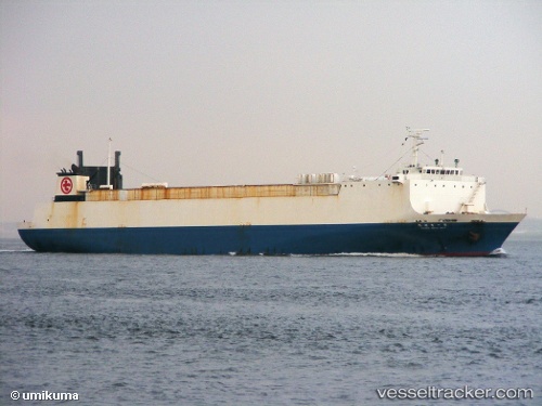
Vessel IRTYSH IMO: 9031789, MMSI: 667002343 Ro Ro Cargo Ship
UTC, 35.06127, 129.00697, course: 176, speed: 0
UTC, 35.06127, 129.00697, course: 176, speed: 0
2026-02-03 04:17:09 UTC, 35.06130, 129.00700, course: 176, speed: 0
Live AIS position:
UTC. Near Gamcheon/Busan),
updated 2026-02-03 04:17:09 UTC.
Find the position of the vessel IRTYSH on the map. The latter are known coordinates and path.
marine traffic ship tracker show on live map
The current position of vessel IRTYSH is 35.06130 lat / 129.00700 lng. Updated: 2026-02-03 04:17:09 UTCCurrently sailing under the flag of Sierra Leone
Details:
Last coordinates of the vessel:
UTC, 35.05094, 129.00725, course: 320, speed: 6.7UTC, 35.06127, 129.00697, course: 176, speed: 0
UTC, 35.06127, 129.00697, course: 176, speed: 0
2026-02-03 04:17:09 UTC, 35.06130, 129.00700, course: 176, speed: 0