 vesseltracker.com
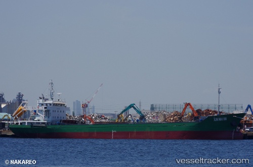
Vessel HOANG TRIEU 99 IMO: 8679364, MMSI: 668116273 Cargo
UTC, 20.86474, 106.75583, course: 161, speed: 0.1
UTC, 20.86482, 106.75577, course: 161, speed: 0
2026-03-14 16:14:53 UTC, 20.86472, 106.75561, course: 152, speed: 0.2
Live Vessel HOANG TRIEU 99 Analytics (details, animations, etc.)
Live AIS position: UTC. Near HAI PHONG), updated 2026-03-14 16:14:53 UTC.Find the position of the vessel HOANG TRIEU 99 on the map. The latter are known coordinates and path.
marine traffic ship tracker show on live map
The current position of vessel HOANG TRIEU 99 is 20.86472 lat / 106.75561 lng. Updated: 2026-03-14 16:14:53 UTCCurrently sailing under the flag of Sao Tome and Principe
Details:
Last coordinates of the vessel:
UTC, 20.86277, 106.75556, course: 353, speed: 0UTC, 20.86474, 106.75583, course: 161, speed: 0.1
UTC, 20.86482, 106.75577, course: 161, speed: 0
2026-03-14 16:14:53 UTC, 20.86472, 106.75561, course: 152, speed: 0.2