 vesseltracker.com
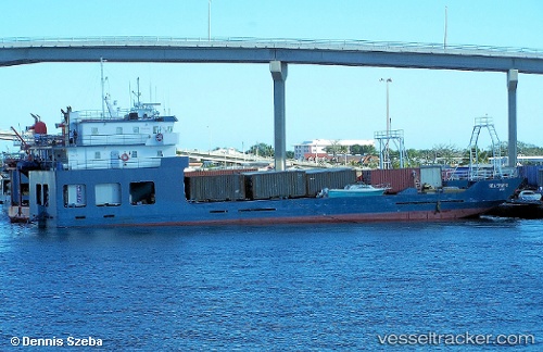
Vessel RELIANCE II IMO: 9221322, MMSI: 671226100 General Cargo Ship
UTC, 25.22626, -76.78293, course: -1, speed: 7
UTC, 25.23321, -76.71192, course: -1, speed: 7.3
2026-01-18 06:04:32 UTC, 25.23815, -76.61804, course: -1, speed: 7.5
Live AIS position:
UTC. 16 nm S of Harbour Island),
updated 2026-01-18 06:04:32 UTC.
Find the position of the vessel RELIANCE II on the map. The latter are known coordinates and path.
marine traffic ship tracker show on live map
The current position of vessel RELIANCE II is 25.23815 lat / -76.61804 lng. Updated: 2026-01-18 06:04:32 UTCCurrently sailing under the flag of Togo
RELIANCE II built in 1999 year
Deadweight:
750 tDetails:
Last coordinates of the vessel:
UTC, 25.26831, -76.93153, course: -1, speed: 7.2UTC, 25.22626, -76.78293, course: -1, speed: 7
UTC, 25.23321, -76.71192, course: -1, speed: 7.3
2026-01-18 06:04:32 UTC, 25.23815, -76.61804, course: -1, speed: 7.5