 vesseltracker.com
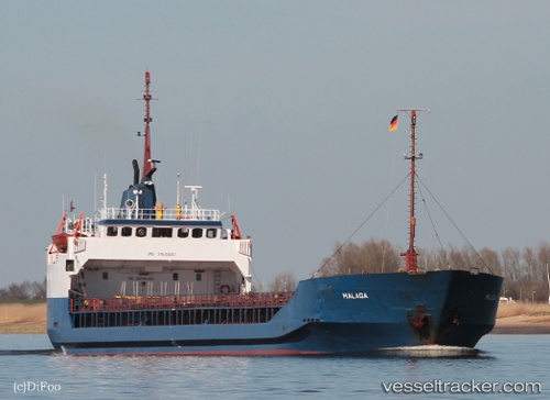
Vessel BARACUDA IMO: 7514440, MMSI: 671370100 General Cargo Ship
UTC, 40.85923, 29.28440, course: 107, speed: 0
UTC, 40.85923, 29.28440, course: 107, speed: 0
2026-02-14 08:39:13 UTC, 40.85923, 29.28440, course: 107, speed: 0
Live AIS position:
UTC. Near Sabiha Gokcen Apt/Istanbul),
updated 2026-02-14 08:39:13 UTC.
Find the position of the vessel BARACUDA on the map. The latter are known coordinates and path.
marine traffic ship tracker show on live map
The current position of vessel BARACUDA is 40.85923 lat / 29.28440 lng. Updated: 2026-02-14 08:39:13 UTCCurrently sailing under the flag of Togo
BARACUDA built in 1977 year
Deadweight:
4034 tDetails:
Last coordinates of the vessel:
UTC, 40.85925, 29.28440, course: 107, speed: 0UTC, 40.85923, 29.28440, course: 107, speed: 0
UTC, 40.85923, 29.28440, course: 107, speed: 0
2026-02-14 08:39:13 UTC, 40.85923, 29.28440, course: 107, speed: 0