 vesseltracker.com
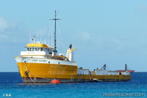
Vessel Lady.romney IMO: 7047203, MMSI: 671960000 Offshore Tug Supply Ship
UTC, 18.35800, -64.58631, course: -1, speed: 0.1
UTC, 18.35772, -64.58641, course: -1, speed: 0.3
2026-03-10 09:29:25 UTC, 18.35805, -64.58635, course: -1, speed: 0.3
Live Vessel Lady.romney Analytics (details, animations, etc.)
Live AIS position: UTC. Near NORMAN ISLAND), updated 2026-03-10 09:29:25 UTC.Find the position of the vessel Lady.romney on the map. The latter are known coordinates and path.
marine traffic ship tracker show on live map
The current position of vessel Lady.romney is 18.35805 lat / -64.58635 lng. Updated: 2026-03-10 09:29:25 UTCDetails:
Last coordinates of the vessel:
UTC, 18.35730, -64.58621, course: -1, speed: 0.2UTC, 18.35800, -64.58631, course: -1, speed: 0.1
UTC, 18.35772, -64.58641, course: -1, speed: 0.3
2026-03-10 09:29:25 UTC, 18.35805, -64.58635, course: -1, speed: 0.3