 vesseltracker.com
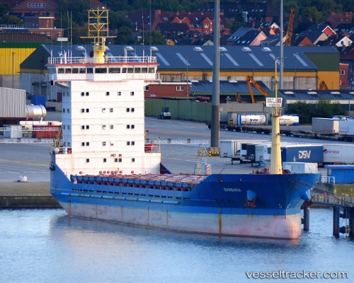
Vessel AMGU IMO: 9113226, MMSI: 677022600 General Cargo
UTC, 42.95690, 132.36363, course: -1, speed: 8
UTC, 42.95518, 132.36197, course: -1, speed: 7.6
2026-03-13 04:11:20 UTC, 43.09838, 131.88213, course: -1, speed: 0.4
Live Vessel AMGU Analytics (details, animations, etc.)
Live AIS position: UTC. Near Vladivostok), updated 2026-03-13 04:11:20 UTC.Find the position of the vessel AMGU on the map. The latter are known coordinates and path.
marine traffic ship tracker show on live map
The current position of vessel AMGU is 43.09838 lat / 131.88213 lng. Updated: 2026-03-13 04:11:20 UTCCurrently sailing under the flag of Tanzania
Details:
Last coordinates of the vessel:
UTC, 42.95690, 132.36363, course: -1, speed: 8UTC, 42.95690, 132.36363, course: -1, speed: 8
UTC, 42.95518, 132.36197, course: -1, speed: 7.6
2026-03-13 04:11:20 UTC, 43.09838, 131.88213, course: -1, speed: 0.4